An exciting look at the western side of the ancient Indus civilization, where new cultures and surprises await that indicate how well developed surrounding cultures to the major Indus areas were.
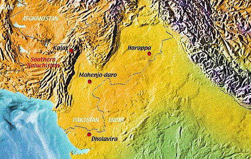
Baluchistan is Pakistan's largest province (1). It is marked by a rugged, highly differentiated environment with many different habitats (2). The Makran Range in the south divides the interior from the coastal plain. A number of successive mountain chains run from the Arabian Sea to the Hindukush, and form a barrier towards the fertile Indus plain in the east.
Introduction
These mountains enclose interior highland basins and deserts and are intersected by many river valleys (3,4).
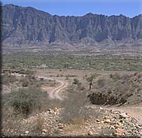
 Southeastern Balochistan is characterized by narrow river valleys which only occasionally provide space for alluviation, and thus agriculture. The catchment areas are smaller and, due to the high gradient of the tributaries, the seasonal floods are often destructive and wash away the soil (5).
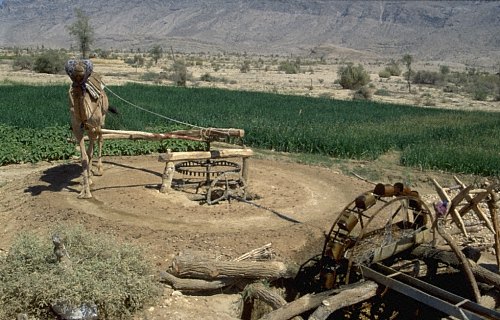
In such a harsh and barren environment, irrigation through channels, qanats, or seasonal flooding is an essential prerequisite for settlement (6). It thus developed early as an essential measure for the production of crops required by a growing population. The rising number of settlements from the beginning of settled life in the 6th millennium through the mid-third millennium BC witnesses the success of food production through farming and pastoralism.
Pioneering archaeological fieldwork in this region was carried out by the great explorer Sir Aurel Stein, Hargreaves, W.Fairservis, B. de Cardi, J.-M. Casal, G.Dales, the Dept. of Archaeology and Museums, Karachi, and a couple of other explorers.
The French excavations at Mehrgarh, Nausharo and Pirak in the Kachhi plain revealed a long cultural sequence from the Neolithic Period through the Iron Age. While another French Mission resumed work in Makran after a 30 year long gap in the late 1980's, southeastern Balochistan had remained a "white spot" on the archaeological landscape.
In winter 1996-7, the Joint German-Pakistani Archaeological Mission to Kalat was founded to re-open work in this area.

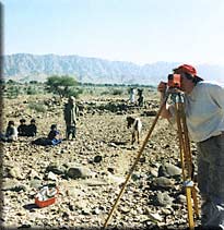
To date, three seasons of exploration were carried out in the plain of Las Bela, in the Kanrach and the Greater Hab (Hab, Saruna, Bahlol, Loi, Talanga) River valleys, and long the eastern foot of the Kirthar Range, covering altogether about 1900 square kilometers. As a result of this work, more than 300 archaeological sites were discovered and documented (7,8, 9).
Many of them were threatened by destruction. The large number of prehistoric settlements, the size and sophisticated lay-out of some of them came as a surprise: nowadays the area is barren and inhabited by a few people. Interestingly, the sites indicate that a development from village to town and then to camp, and from agriculture to migratory pastoralism took place.