Vainiwal was first identified by M. Sharif (1989) prior to the PAS. It is located approximately 100 km upstream of the Beas confluence with the present Chenab (Figure 3). While other mounded sites occupied the Bari Doab (see Lohoma Lal Tibba below), the doab topography grades almost imperceptibly to the Holocene alluvial plain at Vainiwal. The most prominent features of the landscape are a series of lozenge shaped linear dunes oriented south to southeast that flank the distal margins of the ancient stream channel. It is probable that during the later Holocene the course of the Beas, its localized meandering regime, and its depositional patterns were modified by dune activity that extended for at least 10 km downstream.
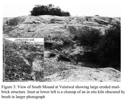
Our investigations at Vainiwal were conducted between 1997 and 2001 during short periods between academic semester breaks and two longer field seasons in 1999 and 2001. The site rises 7 – 12 m. above the dune fields and broader Beas plain and consists of three interconnected mounds. A narrow saddle connects the oval-shaped northern mound to the central and southern mounds, which are oblong to circular in shape. In Harappan times it is probable that the landform was once continuous, since more robust structural features – for example, streets, foundation walls, platforms – mark the edges of mound segments. These clay and mud reinforced structures have proved resistant to sustained long-term erosion. The current set of elongated lobes fanning out from the mid-slopes to the outer mound margins are evidence of the former margins of active headcuts. Towards the center and upper elevations of the mound segments, kilns and firing stations remain visible on the surface of the site.

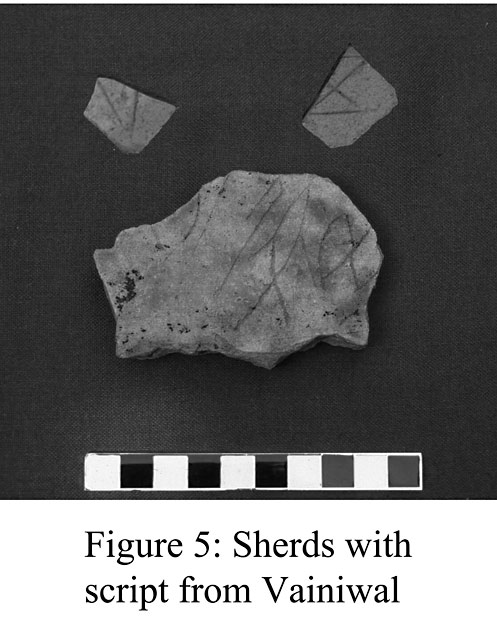
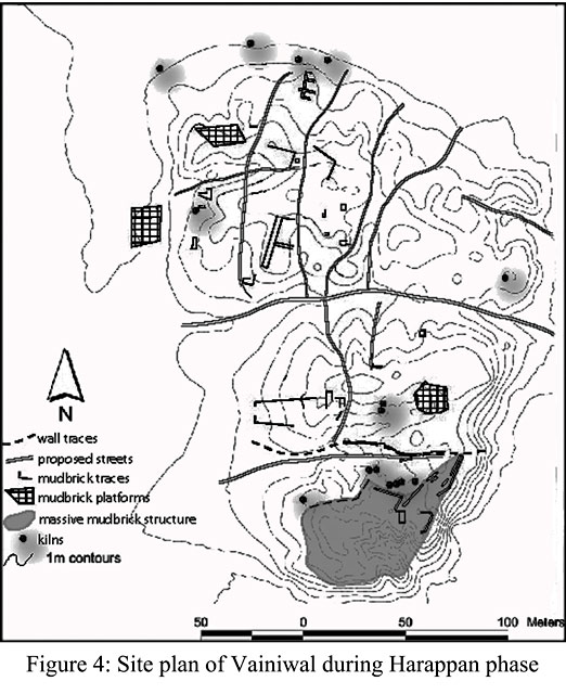
Figure 4 shows the site plan of Vainiwal during the Harappan phase. Mapping of site features revealed substantial evidence for past activities including foundation walls, streets, a mudbrick platform, and craft activities. Among the small finds at various locations, but not shown on the map, were terracotta animal figurines, carts and wheels; terracotta and shell bangles; chert blades and cores; faience, steatite and terracotta beads; grinding stones and pestle fragments; copper and unworked stone, and lapis lazuli. There also were small concentrations of inscribed sherds (n=34). The images on Figure 5 are from Harappan contexts. Some have only one sign, while others include several. The highest density of inscribed sherds was at the southern edge of the central mound near the kilns and wall traces.
During the four-year period in which we visited Vainiwal, it remained one of the best preserved sites in our survey, although investigations beyond the mound in agricultural fields and at the edges of the village indicated that encroachment had taken place over time. These investigations demonstrated that the site likely approximated 7 hectares, somewhat larger than the 4 hectares recorded by the PAS.
The field research at Vainiwal followed the methodology outlined earlier in Figure 1 and included preparing contour maps, recording mound profiles, augering of two subsurface cores, excavating a test trench, identifying remnant features, and systematic sampling and recording of surface materials. In this paper, our focus is on our sampling and collection of surface materials and the test trench on the interior of the central mound.